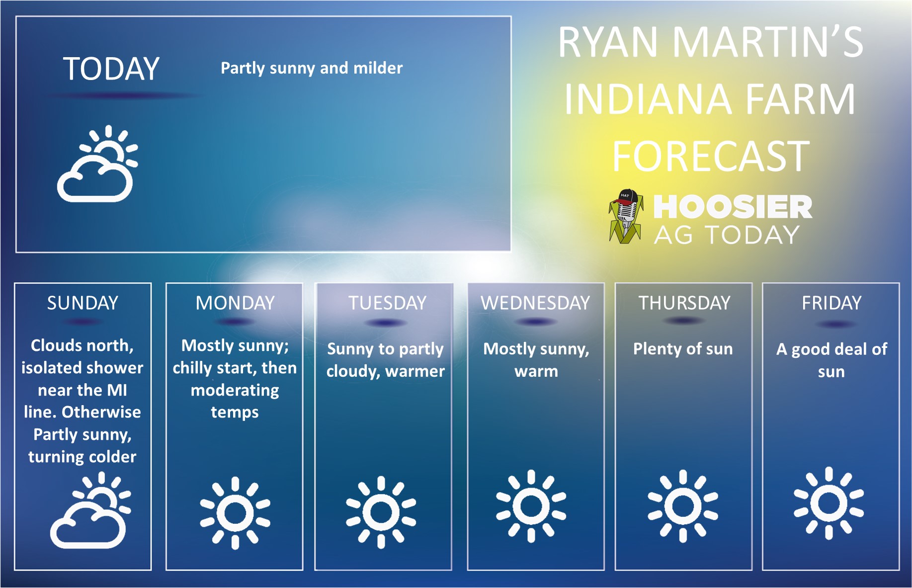
 Dry to start this harvest forecast period on Saturday. Temps remain above normal, evaporation high and humidity values low. Sunshine dominates. We expect more clouds statewide on Sunday, as the remains of Hurricane Delta pass by to the south. The low tracks over TN and KY, but the footprint of this storm is large…so getting clouds thrown up into IN is likely. Showers are less likely, but if you are in far southern tier counties, keep an eye out for some scattered showers potentially Sunday midday. We really think moisture is not a big story out of the remains though over most of the state.
Monday our next cold front arrives form the west and north. Clouds thicken up quickly in the morning and by midday to early afternoon we will see scattered showers moving over areas from I-70 north. The chance of precipitation runs up to midnight and then is done. Rain totals will be from a few hundredths to .4” max from I-70 north, and only a few hundredths south of I-70. Coverage will be around 75%.
Partly to mostly sunny conditions in for Tuesday and Wednesday. Temps stay normal to slightly above normal and we should see good evaporation. Harvest should be able to ramp back up in that window in many areas. Thursday starts with sun, but clouds will increase in the afternoon.
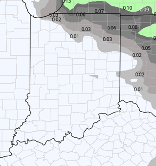
Our second front for the week comes through Thursday night. This front sagging more north to southeast. There is little moisture with it now…only a few hundredths to a tenth or two with 60% coverage. However, the bigger story is the change in air mass that comes behind it. Temps will be significantly cooler. We expect below normal temps for next Friday, Saturday and Sunday. In fact, we could see an end to the growing season overnight next Saturday night with a frost and freeze over parts of the state, at least in central and northern Indiana. The map below shows combined rain totals for the 10 day window…nothing here that screams “long term delay.”
 Extended Period:
The extended 11-16 day forecast period is cool for the first 4-5 days. WE expect below normal temps to continue through at least Friday the 23rd. We should see mostly dry weather in that window though, with satisfactory drying. Skies will be at least partly sunny for most of that week of the 19th. A minor disturbance lifts north into the state overnight Friday night (23rd) into Saturday the 24th. This will bring a few hundredths to .3”to central and northern Indiana with 70% coverage. But it will also bring warmer air in too, as temps climb to above normal levels for that weekend of the 245h-25th. But the cold front circulates through for the afternoon of the 25th, bringing potential for .5”-1.5” rains over 90% of the state.
Weeks 3 & 4:
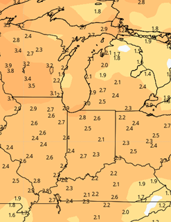
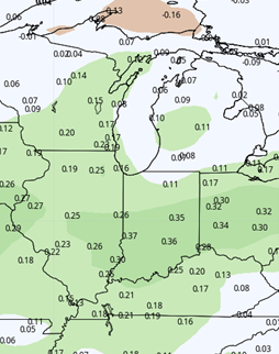
After several weeks of the far extended period looking warm and dry, we are seeing temps break just a bit and seeing a bit more moisture potential. For week three, temps pull back to near normal, likely on the cold air that dominates our 11-16 day window running forward into the following week. We also see near normal moisture, thanks to a strong front right there at the start of the week three period (coming out of the extended forecast period above). For week 4, we stay near normal on precip, but see warming temps for the first week of November.
Week 3
Precipitation (green: above normal, brown: below)
 Temperatures (blue: below normal, orange: above)
 Week 4
Precipitation (green: above normal, brown: below)
Temperatures (blue: below normal, orange: above)