[the_ad id=”98426″]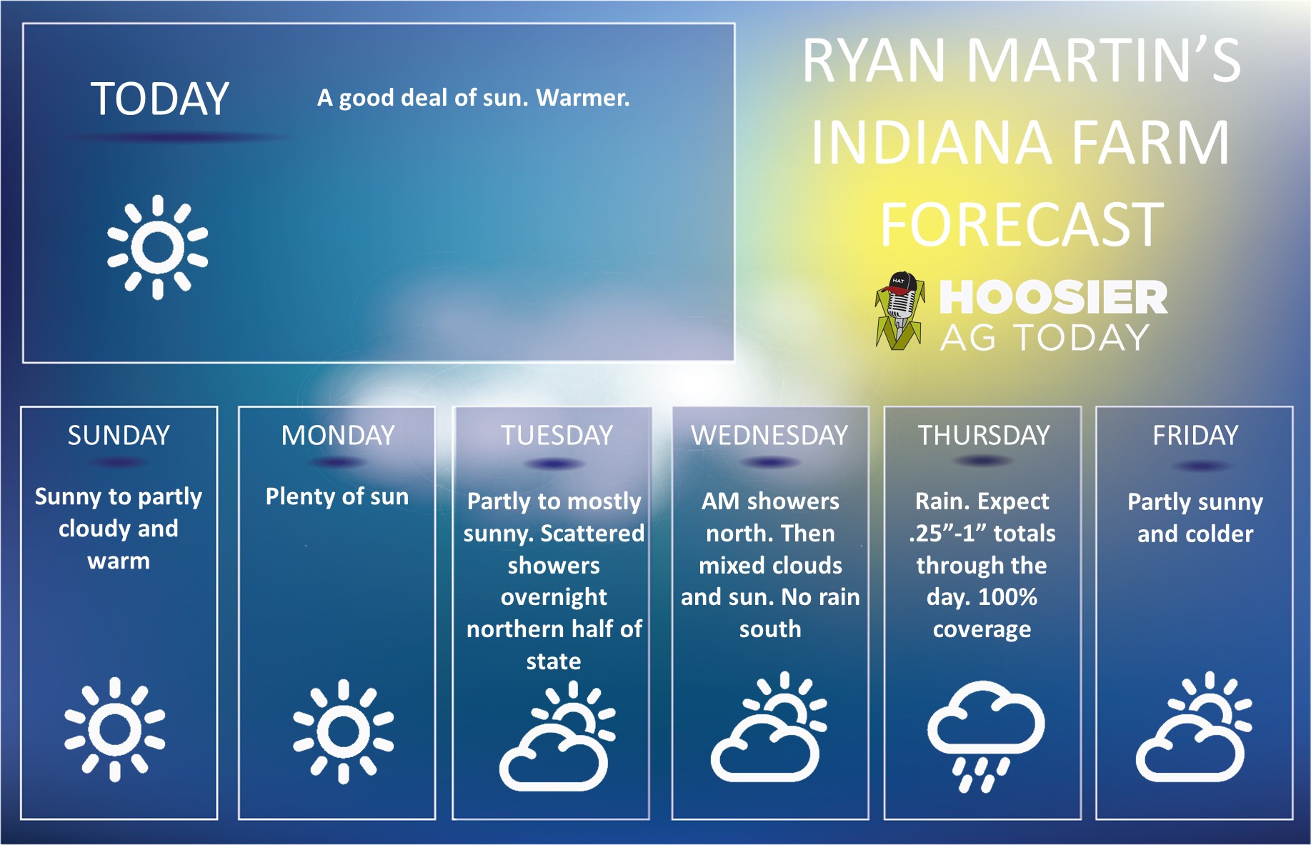 Dry weather remains a main part of our harvest forecast this week, but we will see our dry window close for a bit with some rain developing the second half of this coming week. However, we still see opportunities early to work through harvest, and we will return to a mostly rain free pattern again behind this week’s rain, albeit with a big drop in temps again.
We are sunny, warm and dry for the weekend through Tuesday. Temps will be above normal, especially Sunday through Tuesday. These will be the days that evaporation is at its best, and we see the most significant drying.
Clouds build overnight Tuesday night and early Wednesday, with scattered showers working through the Great Lakes and over northern IN during that time frame. Moisture totals are not large, mostly a few hundredths to .25”, but there will be some moisture around. Clouds give way to sun again Wednesday afternoon, and temps stay mild, although not as warm as earlier in the week.
Thursday clouds build again, and we see a strong cold front sweeping through from later Thursday afternoon through Friday morning. Rain totals will be .25”-1” and can have a few locally higher totals, with coverage at 100% of Indiana. We all are getting wet sometime Thursday afternoon, Thursday overnight or early Friday morning.
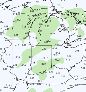
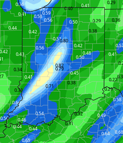 Significantly colder air comes in behind the front for Friday and the weekend. However, we do not see additional moisture on the wrap around at this time, as that stays farther north up into MI. We expect a mix of clouds and sun, but temps will likely be as cold or colder than what we saw earlier this week. That chill stays through Monday and the end of the 10 day forecast window as well. The map at right shows cumulative rain totals for the Tuesday night through Saturday period.
[the_ad id=”100306″]
Extended Period:
Tuesday the 16th we start to see a system trying to develop down in the OH valley that may trigger some showers for Tuesday night through Wednesday the 17th. This system then picks up support from a low coming out of the plains Wednesday afternoon and Thursday the 18th. The entire complex likely triggers rain on the order of .25”-1” over 100% of Indiana for the 3 day period. Behind it we return to a drier pattern again for the 19th through the 21st, but we get another surge of cold air from the north. Confidence in the rain for the 16th-18th is marginal at this time, as we don’t like the “origin story” of the disturbance. However, something will develop there, but we believe rain totals from the event are likely to ease back slightly as we get closer to the event, and the timing will go from a 3 day potential event not more like 24-36 hours.
Weeks 3 & 4:
[the_ad id=”100305″]
Slightly above normal precipitation for week 3 while we dry out in week 4. Look for below normal temps in week 3 and only a small recovery to near normal in week 4. We definitely are seeing the warmth over the next 3-5 days as the last warm surge of the fall season.
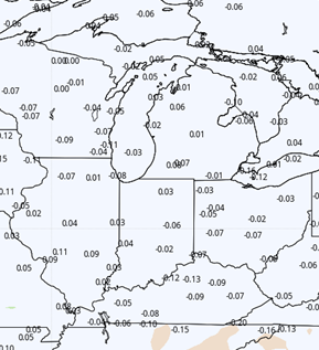
Week 3 Precipitation and Temps
[the_ad id=”100303″]

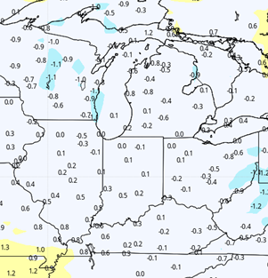
Week 4 precipitation and temps.
[the_ad id=”100306″]